








By Kelvin Obambon
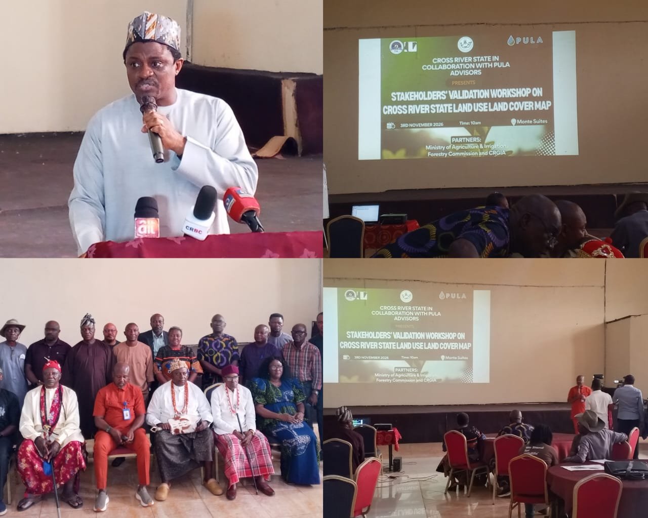
Stakeholders in Cross River on Tuesday validated an updated land use and land cover map aimed at strengthening agricultural traceability, supporting compliance with international deforestation regulations, and guiding sustainable forest and land management.
The workshop, held in Calabar, was organized by the Cross River State Forestry Commission in partnership with the State Ministry of Agriculture and Irrigation Development, the Cross River Geographic Information Agency (CRGIA) and Pula Advisors. It forms part of a broader seven-year strategic roadmap for cocoa, coffee and oil palm development.
Hon. Johnson Andiambey Ebokpo, the Commissioner for Agriculture and Irrigation Development, said the mapping exercise is central to the state’s “people’s first” agenda. “We are going to build those systems that make life easy and put money in the pockets of our people. And that’s why we are here today,” he told participants.
READ ALSO: Atiku Slams Otu After Governor’s Neighbours Were Allegedly Robbed in Calabar
He explained that updating the land use and land cover map was a cross-cutting pillar of the roadmap, alongside the development of a traceability system that would enable farmers to meet international standards and eventually export directly.
Ebokpo stressed the need for accurate maps to support regulation from farm to warehouse, enforce grades and standards, and assure buyers that commodities were not grown in protected reserves. “How do you even establish a traceability system if the maps you are using are still very old? And that is what has given rise to the maps that Pula has developed and we are here today to validate it,” he said.
The Commissioner invited stakeholders to flag spelling errors, overlaps or other inaccuracies so the final product could be submitted to the governor and subsequently considered by the State Executive Council and the House of Assembly.
Dr George O’ben-Etchi, Chairman of the Cross River State Forestry Commission, said the exercise would provide ready data on forests, agroforestry areas and farmer locations. He noted that the commission had engaged Pula Advisors after the governor set up a strategic committee for cocoa, oil palm and coffee sector.
“That map would give us an idea about where our forests are, where we are in terms of agroforestry, where we are in terms of our farmers,” he said.
O’ben-Etchi highlighted ongoing efforts to move away from slash-and-burn practices and towards sustainable forest management, including the recruitment of forest rangers and reforestation initiatives.
William Archibong, Director General of CRGIA, emphasised the role of geographic information systems in providing the base maps and precise locations needed for the work. He noted that the classification covered changes from 2015 to 2025 and would help identify areas affected by deforestation. “We cannot work with old maps of 2015. So we need to have upgraded maps so that we can provide our services better,” Archibong said.
Professor Susan Ohen, Chairman of the Cross River State Multi-Stakeholder Committee for Cocoa, Coffee and Oil Palm Strategic Plan Development, linked the validation directly to European Union Deforestation Regulation (EUDR) compliance. “This activity is very important to the fact that we need to have a traceable cocoa system or tree crop system,” she said. “One of the ways to make our cocoa and tree crops traceable is by having these maps for us to know where we are cultivating. Are we cultivating in forested areas or deforested areas?”
Dr Michael Enahoro, Country Director of Pula Advisors, described the mapping as the result of about 10 months of work involving geospatial analysis, ground truthing and polygon mapping of more than 19,000 farms, building on data reviewed from 2015 to the present.
He reported that more than 200,000 hectares of forest had been degraded or lost in the period, a challenge linked to population growth and rising demand for food and commodities. “You have to strike a fine balance between food and forests,” Enahoro said. He praised the state for updating its maps to current realities and positioned Cross River as one of the few states in Nigeria preparing for EUDR compliance on export crops such as cocoa, coffee and oil palm. He described agroforestry as a practical path forward.
HRM Amb. Anthony Ntui Etta, Paramount Ruler of Etung, welcomed the effort but urged stronger protection of remaining forests. He called on government to intensify action against illegal logging and encourage replanting in abandoned cocoa areas rather than further encroachment into forests.
In a communiqué issued at the end of the workshop, participants observed that the map provides an important spatial baseline for land administration, agricultural development, forest conservation, biodiversity protection and climate action. They recommended technical corrections based on stakeholders input, further ground truthing where classifications were uncertain, integration of existing geospatial data from relevant ministries, departments and agencies, and mechanisms for periodic updating.
The validated map, once finalised, should serve as a reference dataset for evidence-based decision-making, environmental impact assessments and climate resilience initiatives, and should be made accessible to authorised users.
Participants also expressed appreciation to the state government, organising institutions and technical partners, and called for sustained collaboration and capacity building to keep the map relevant.